History
Pal Pauer’s mentor Hydrologist and Mining Engineer Dr. Stephan Riess was convinced that the primary water source for California City (California) originated from the Garlock Fault. His dream for testing his hypothesis materialized when Pal Pauer drilled two test boreholes adjacent to the Garlock Fault in the Tehachapi Mountains at a 6,000-foot elevation. The outcome is remarkable!
Timeline
- April 15, 2015 Primary Water Institute (PWI) founder Pal Pauer (Pal) was approached by clients for a feasibility study for locating several primary water wells on their property. They provided topographic maps and approximate desired well locations. Pal determined the project was feasible.
- July 4, 2015, Pal made a site visit to the Tehachapi Mountains to verify the information provided on the maps. Pal spent one week on site investigating viability and likelihood of primary water at this elevation (6,000 feet). He found a vent or fumarole which was adjacent to the fault and represented a site favored by the property owners. Consequently, the owners and Pal determined and marked locations for 2 wells on the property. Further investigation and drilling test boreholes was the next step.
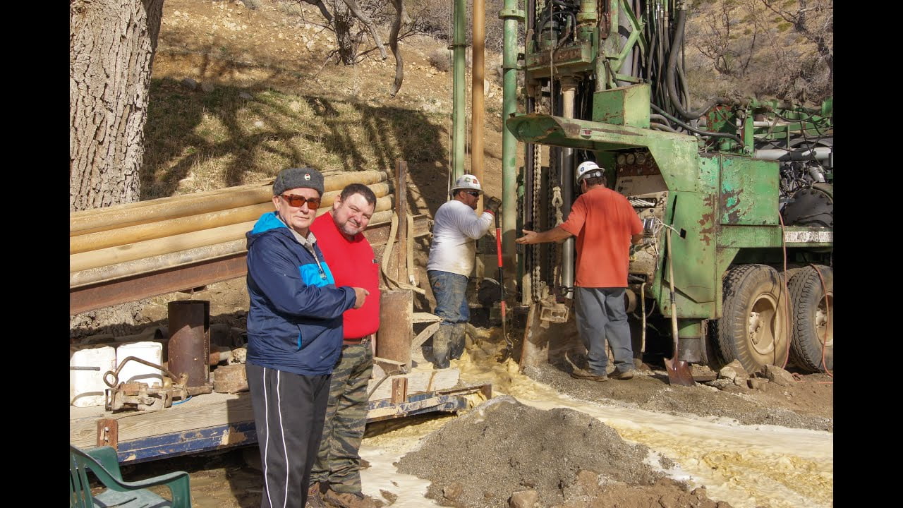
- A search ensued for a suitable drilling rig to make the project possible. Several drilling firms were considered and it was decided by the property owners and Pal that Paul Hern Drilling Inc. had the knowledge and equipment that could drill the wells. Note the state of the drilling rig.
- Dec 6 2015, a trip was made by Pal from his home in Oregon to the Tehachapi’s to over-see the project.
- Dec 8 Arrived on client’s property to start drilling
- Dec 9 at 8:30am, drilling begin on site. The first test well was named Maryanne 1. A highly fractured meta-volcanics was encountered at 20 feet which led to the probability of water. Further drilling into the structure where large fractured material was ejected under air pressure along with an ever increasing quantity of water. Work had to be stopped about 100 feet in depth due to the lack of availability of air volume and pressure to remove debris and water. It is estimated that the water that was ejected from a 7-inch diameter borehole was at the rate of 800 plus gallons per minute. Further progress could not be made with available volume of air and pressure. It was determined that water was very good quality between 150 to 250 PPM/L – total dissolved solids (TDS).
- The drilling rig was moved to the second well site named Heather 1. This location is part of the same rim of the vent/fumarole that is estimated to be between 2-5 feet in width.
- Dec 10, approximately 100 yards across from first site, the same procedures were followed and water was encountered in larger quantity at a 60-foot depth and drilling could not proceed any further due to inability to remove water/cuttings and debris.