TEXT OF COMPLETE ARTICLE
Indian Ocean Tsunami. Why did the Information Not Get Out?
by Michel Chossudovsky
February 7, 2005
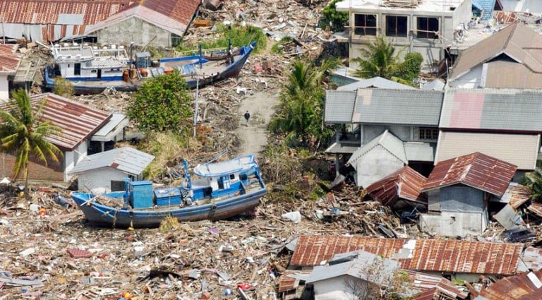
One of the most destructive and powerful earthquakes in recorded history, more than a quarter of a million recorded deaths, local economies destroyed, the lives of entire communities shattered, and no serious investigation into the flaws of the global seismic warning system is contemplated.
According to Columbia University’s Earth Institute the M-9.0 Sumatra – Andaman Island earthquake on December 26th released energy, equivalent roughly to 700 million Hiroshima bombs.
Seismic information regarding what scientists identify as a “rare great earthquake”, was available in near real time (i.e. almost immediately) to seismic centers around the World.
Other types of data, including satellite imagery were also available in near real time.
The advanced global seismic information and communications systems were fully operational.
Why then, did the information not get out on the morning of December 26th?
Ten of thousands of lives could have been saved.
The issue has been skirted by the Western media, sidestepped by the governments and the UN, not to mention the international scientific community.
The blame was casually placed on the Indian Ocean countries, described as having “inadequate communications systems”, not to mention the local people who “have to be trained to know what to do…If the people don’t respond, don’t understand what the communication is all about, it is for naught.” (Washington Times, 30Dec 2004)
What Happened on the Morning of December 26th?
The tsunami was triggered within minutes of the earthquake, prior to the release of the first tsunami advisory bulletin by the Pacific Tsunami Warning Center (PTWC) in Hawaii, so it was no longer a question of emitting “a warning” of an imminent danger. The catastrophe had already happened.
In other words, by the time the first tsunami bulletin had been issued at 01.14 GMT, the deadly seismic wave was already sweeping Banda, the capital of Aceh province in Northern Sumatra, causing thousands of deaths.
Moreover, this ex post facto bulletin emitted by the PTWC, not only failed to acknowledge an ongoing disaster, it did not even warn of the potential danger of a tsunami, when the deadly seismic wave had already started, devastating densely populated areas. (PTWC bulletins apply to the Pacific as well as regions adjacent to the Pacific. For details, see:Discrepancies in the Tsunami Warning System )
Inconsistencies in the Tsunami Bulletins
Three days earlier, on the 23d of December, a M-7.9 earthquake was recorded with an epicenter off the South Pacific MacQuarie islands The PTWC issued the following routine tsunami advisory:
“THIS EARTHQUAKE HAS THE POTENTIAL TO GENERATE A WIDELY DESTRUCTIVE TSUNAMI IN THE SEA NEAR THE EARTHQUAKE. AUTHORITIES IN THAT REGION SHOULD BE AWARE OF THIS POSSIBILITY.”
Why then in the case of a M-9.0 earthquake, which is more than ten times greater in magnitude than a M-7.9 earthquake, did the PTWC authorities fail to even issue a tsunami warning?
An event of this type and magnitude is known as a “megathrust,” which in its specific Indian Ocean location is said to occur “approximately every few hundred years.” (See Columbia University Earth Institute ).
Scientists in fact suggested that the quake had unleashed enough energy that “it could have rocked the earth off its axis.” (See: Huge quake resonates, Carolyn Y. Johnson, Boston Globe)
In other words, the least one would have expected in the case of a “megathrust” was a similar routine statement to that issued in relation to the McQuarie islands earthquake, three days earlier, on December 23. (see: Discrepancies in the Tsunami Warning System )
The first bulletin emitted on the 26th not only failed to conform to established criteria used in previous and subsequent seismic occurrences, it casually dismissed an established and scientifically accepted relationship. According to
“If it were a 9 earthquake … with the thrusting in an ocean basin margin, the likelihood is almost 1:1 that it would generate a tsunami” (Dr. Charles Groat, Director, US Geological Survey in testimony to the Science Committee of the US House of Representatives, 26 Jan 2005).
The Earthquake took place at 00.58.50 GMT on the 26th of December. Roughly five minutes later it had hit the coast of Northern Sumatra, 11 minutes after the earthquake it devastated Banda, capital of Aceh. Fifteen minutes after the earthquake, at 01.14 GMT the Pacific Tsunami Warning Center in Hawaii confirmed in its bulletin:
“THERE IS NO TSUNAMI WARNING OR WATCH IN EFFECT”
Moreover, both official and news reports out of Aceh province, following the disaster, were either delayed or were not transmitted on time.
In other words, despite the dramatic nature of the quake, the seismic information, which was available in real time, failed to reach the countries affected by the seismic wave.
Why were the countries not informed of an impending disaster?
In the words of Maine Senator Olympia Snowe:
“… what efforts, if any, were made to contact those other nations in the region that were also in harm’s way? If NOAA did not have the appropriate contacts, as has been reported, why was this the case? Was an attempt made to obtain that contact information – and if not, why not? These are questions that must be answered.”
The Western media not only failed to address the failures in the warning system, they admonished those who raised the issue.
In fact, any serious analysis of the warning system was dismissed outright.
A few press reports, nonetheless, confirmed that, with the exception of Indonesia and Australia, the Indian Ocean countries had not been informed. These same reports, largely based on statements of the Pacific Tsunami Warning system (PTWC) in Hawaii, also acknowledged that the US State Department and the Military, including the US Navy base on the island of Diego Garcia in the Chagos Archipelago had been duly notified.
In retrospect, however, these earlier press reports (including our own analysis ) need to be qualified. Published in the immediate wake of the disaster, they quote official statements to the effect that the US government and military had been informed by the PTWC, when in fact the PTWC was on the “receiving end” of the flow of seismic data. (See Foreknowledge of a Natural Disaster , Richard Norton Taylor, US island base given warning: Bulletins sent to Diego Garcia ‘could have saved lives’, The Guardian, Jan 2005).
The Information was Known to an Entire Network of Organizations
Upon closer examination, the PTWC bulletins are but the tip of the iceberg: The information on the quake was known and available in real time, to an entire network of seismic organizations. It was also on hand and accessible to a number of government agencies both in the US and internationally, almost immediately. Numerous officials, scientists, members of the military and intelligence services, had advanced knowledge of an impending disaster.
In other words, we are not dealing with the failures of a single warning Center in Ewo, Hawaii, but with an entire Worldwide network of seismic information, satellite imagery and other sophisticated data, which was available almost immediately.
Who informs Whom?
The question is not why the PTWC did not emit a tsunami warning but why did an entire global network of scientists and officials not emit a warning, in relation to one of the largest quakes in recorded history.
While the PTWC had indeed formally notified Washington and the Military at the Diego Garcia island base, the US government and military already knew, because the seismic data had been processed within minutes by an agency under the jurisdiction of the US Department of the Interior, namely the National Earthquake Information Center (NEIC) based in Golden (close to Denver), Colorado.
Fukushima Nuclear Plant Hit with 5.8 Earthquake
“The National Earthquake Information Service (NEIS) of the U. S. Geological Survey is located at the National Earthquake Information Center (NEIC) in Golden, Colorado, USA which also serves as World Data Center A for Seismology. The NEIS is a member of the Council of the National Seismic System (CNSS) which coordinates activities among the national and regional seismograph networks, including “finger quake” services. The NEIS is also closely associated with the U.S. National Seismograph Network (USNSN) and cooperates with national and international seismological organizations around the world. Unlike other members of the CNSS, the NEIS is responsible for reporting on moderate to large earthquakes throughout the U. S. and large earthquakes worldwide… On an immediate basis, all Earthquake Early Alerting Service alarm events will be made available to the “quake” list. At a minimum, this includes… most foreign earthquakes of magnitude 6.5 or greater. In practice, many foreign earthquakes smaller than a magnitude of 6.5 will also be provided on an immediate basis…”
For further details: See:
The seismographic data did not originate at the PTWC, which is part of the Weather Service of the National Oceanic and Atmospheric Administration (NOAA) under the jurisdiction of the US Department of Commerce.
The seismic data was recorded both within the Indian Ocean region and around the World by a number of stations, relayed to a network of seismic centers in a number of countries. (see below).
In other words, omissions and failures in the warning system, not to mention red tape, were by no means limited to the PTWC, which is integrated into a global information network which records, processes and transmits seismic data in near real time. Several key organizations (including the Earthquake Information Center World Data Center for Seismology, Denver (NEIC) and The European Space Agency (ESA) among others, are part of this network, and could have duly advised the countries concerned.
Where did the seismic data originate from?
This issue, which is crucial to understanding the flaws in the seismic warning system, was barely mentioned by the media.
The data regarding the magnitude of the earthquake originated from four seismic stations located in the Indian Ocean, operated by the International Deployment of Accelerometers (IDA) Project . The Scripps Institution Of Oceanography (SIO) at the University Of California at San Diego overseas the IDA seismic stations.
In turn, the IDA is integrated into the Incorporated Research Institutions for Seismology (IRIS) and its Global Seismographic Network (GSN ), and into the data system of the National Earthquake Information Center World Data Center for Seismology, Denver (NEIC (WDCS-D)). (See Eric Waddell, The Tsunami: Why Weren’t They Warned? Jan 2005, http://globalresearch.ca/articles/WAD501A.html )
“Received signals three minutes, thirty seconds after the quake began”
In testimony to the US Congress (Jan 26, 2005), Scripps (SIO) Deputy-Director John Orcutt confirmed that “data telemetry”, namely the transfer of data immediately via phone line, cable, or satellite is central to the SIO’s mandate:
“Data acquired via telemetry may be used … as [a] :tsunami warning:… Prompt transmission of the seismic data permits experts to locate earthquakes quickly, assess the likelihood they have generated a tsunami, and predict when the destructive wave will arrive. Such predictions have already saved numerous lives.”(SIO’s Project IDA, http://ida.ucsd.edu/Telemetry/index.html )
Scripps Dr. Orcutt also confirmed that on December 26, the data pertaining to the Sumatra-Andaman quake had been telemetered from 30 IDA stations and had been “immediately and automatically forwarded by computer to the USGS National Earthquake Information Center (NEIC) in Golden, Colorado and the NOAA tsunami warning centers in Hawaii and Alaska”:
“Due to their proximity to the event, IDA stations were critical in the early detection of the December 26th earthquake. The two closest global seismic stations, IDA stations on Cocos (Keeling) Island and Sri Lanka, received signals three minutes, thirty seconds after the quake began. Data from these and other IDA GSN stations in the region were used by the NEIC, and other civil, academic, and military systems to quickly determine the quake’s size and location.” (Statement to the Science Committee of the US House of Representatives, 26 Jan 2005. emphasis added).
Contradicting the substance of his own testimony, Dr. Orcutt stated that Scripps (SIO) officials got the news from the NEIC, by email one hour and 17 minutes after the earthquake, when in fact it was the Scripps IDA stations, that had transmitted the data in near real time to the NEIC in the first place, and that this data had been made available to other agencies, in the US and internationally:
“Scripps staff first learned of the quake at 6:16 PM PST (one hour seventeen minutes after the earthquake) when they received notice via automatic email from the NEIC of the initial earthquake detection. SIO [Scripps Institution of Oceanography] also received an inquiry from the IDA/Sri Lanka operator at 6:57PM (one hour fiftyeight minutes after the quake) asking whether there had been any earthquakes in or near Sri Lanka. The operator had received many phone calls from local residents who had felt tremors and wanted to know the source. SIO’s analyst replied at 7:13PM with information about the NEIC announcement of the earthquake and a plot of the seismic waves recorded by the IDA station in Sri Lanka.” (Ibid)
Not explicitly mentioned in Dr. Orcutt’s statement is that one of the Indian Ocean IDA stations, which transmitted seismic data on December 26th, DGAR (Diego Garcia) is actually located on the site of the US military base in the Chagos Archipelago. (DGAR became operational in January 2004). The other three stations are:
COCO (Cocos [Keeling] Islands located in an Australian administered territory,
In addition to the seismic stations of the IDA/IRIS network, the quake was recorded at stations in a number of countries including China, Russia and Japan, not to mention several “auxiliary seismic stations” in Indonesia as well as one in Sri Lanka. (Parapat, Sumatera PSI Auxiliary Seismic Station AS043 2.7 98 is the closest facility to the epicenter). (See http://ida.ucsd.edu/SpecialEvents/2004/361/a/index.shtml#parameters . Auxiliary Stations as opposed to Primary stations do not transmit data in real time to the IDA)
The Chain of information
Seismographic data was transmitted in real time from the four IDA Indian Ocean stations DGAR (Diego Garcia), COCO (Cocos [Keeling] Islands , PALK (Sri Lanka), and MSEY (Seychelles) to both the IRIS and NEIC centers, where they were then immediately retransmitted (in real time) to the PTWC as well as to other agencies and organizations.
The latest station in the network established in Feb 2004 is Diego Garcia, DGAR.
Source: http://ida.ucsd.edu/IDANetwork/index.html (click map to get Station information)
In other words, while the press reports acknowledge that the Diego Garcia island military base was formally notified of the dangers of a seismic wave, what they failed to mention was that part of the seismic data used by the PTWC to justify its advisory had in fact originated in Diego Garcia, and that the data from Diego Garcia (together with that of three other Indian Ocean stations) had also been transmitted to the IDA/IRIS and NEIC networks.
Continued on next page…