Cosmographiae Introductio (“Introduction to Cosmography”; Saint-Dié, 1507) is a book that was published in 1507 to accompany Martin Waldseemüller’s printed globe and wall-map (Universalis Cosmographia). The book and map contain the first mention of the term ‘America’. Waldseemüller’s book and maps, along with his 1513 edition of Ptolemy’s Geography, were very influential and widely copied at the time.
It is widely held to have been written by Matthias Ringmann although some historians attribute it to Waldseemüller himself. The book includes the reason for using the name America in the wall map and the globe, and contains a Latin translation of the four journeys of Amerigo Vespucci as an appendix.
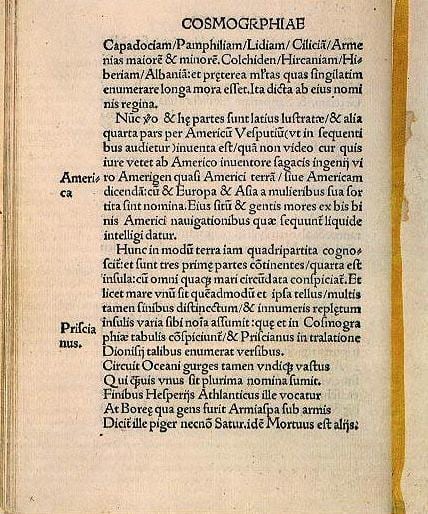
The full title of the book is: Cosmographiae introductio cum quibusdam geometriae ac astronomiae principiis ad eam rem necessariis. Insuper quatuor Americi Vespucii navigationes. Universalis Cosmographiae descriptio tam in solido quam plano, eis etiam insertis, quae Ptholomaeo ignota a nuperis reperta sunt. (translation: Introduction to Cosmography With Certain Necessary Principles of Geometry and Astronomy To which are added The Four Voyages of Amerigo Vespucci A Representation of the Entire World, both in the Solid and Projected on the Plane, Including also lands which were Unknown to Ptolemy, and have been Recently Discovered)
The map of the world in 1507, entitled Universalis cosmographia secundum Ptholomaei traditionem et Americi Vespucii aliorumque lustrationes, was published in an edition of 1000 copies, of which it seems only a single copy survives. The surviving copy was found in the library of Prince von Waldburg-Wolfegg-Waldsee in the Castle of Wolfegg in Württemberg. It was bought by the Library of Congress in 2001. This preservation seems to be due to several sheets being bound into a single cover by the cartographer, Johannes Schöner.
The map consists of twelve sections printed from woodcuts combined with metal types, each measuring 18 x 24.5 inches (46 x 62 cm). Each section is one of four, that form one of three zones. The map uses a modified Ptolemaic coniform projection with curved meridians to depict the entire surface of the Earth.

We all know in 1492 Columbus sailed across the Atlantic and “discovered” America. Well, actually, Columbus did not believe that he had discovered anything. He believed that he had sailed to Asia. In fact he believed the natives he encountered were Indians (of the Indian subcontinent).
Five years later, it would be an agent for the Medici family, Amerigo (or Alberico) Vespucci, who would cross the Atlantic. Vespucci did understand that it was not Asia but a New World. In fact he would publish the record of his journey as the Mundus Novus. This is why the New World was supposedly named after him, or was it?
The name America, however, is actually much older, and had been attached to the new land since the time of the Vikings and before, hundreds of years before the time of Columbus, Cabot or Vespucci.
Amerigo Vespucci
Amerigo Vespucci March 9, 1454 – February 22, 1512) was an Italian explorer, financier, navigator, and cartographer who was born in the Republic of Florence. Sailing for Portugal around 1501–1502, Vespucci demonstrated that Brazil and the West Indies were not Asia’s eastern outskirts (as initially conjectured from Columbus’ voyages) but a separate, unexplored land mass colloquially known as the New World. In 1507, the new continent was named America after the Latin version of Vespucci’s first name. Vespucci became a citizen of the Crown of Castile and died in Seville (1512).
Vespucci was born in March of 1454 three years after Columbus. His family was wealthy and played patron to Michelangelo, Botticelli, and Da Vinci. His cousin Simonetta Vespucci was a beautiful woman who served as a model for Botticelli. Vespucci received his education from Georgio Antonio who tutored Rene II, the future Duke of Lorraine. Readers of Holy Blood, Holy Grail might remember that Rene II was the son of Iolande de Bar, a grandmaster of the Priory of Sion. Iolande’s husband was the lord of Sion-Vaudemont and one of the original knights in the Order of the Crescent.
In Rene’s region of Lorraine was a village called St. Die. It was a little town of woodcutters, brick makers, and flax weavers. The area surrounding St. Die had a reputation of boorish, backward peasants. Amidst the backwoods area was a printing establishment created by the Canon of St. Die who was secretary and chaplain to Rene II. In the employ of this establishment was Martin Waldseemuller, a cartographer, and Matthias Ringmann, an Alsatian professor. Their mission was to produce an edition of Ptolemy’s Geography. In 1507 Rene II received what became known as the Soderini letter. It was a description of the four voyages of Vespucci. It was almost certainly a fake, as Vespucci made only two voyages. Weaving through the crudely written “letter” is the claim that Vespucci deserves the credit, not Columbus. Why would such a text be written? Possibly because the first account of the voyages of Columbus were a best-selling profit source. And who would benefit? The printing establishment itself would benefit, but not because of any specific name. Columbus passed away a year before the book and map were printed so was never part of the issue.
It is likely that a name that sounded like ‘Amerigo’ was assumed to be the explorer’s name. There is evidence that such a name may have been already in use in the New World. Waldseemuller and his scholars were unaware and added “and since Europe and Asia received names of women, I do not see any reason not to call this latest discovery Amerige, or America, according to the sagacious man who discovered it.”
It may have come as a surprise to Vespucci, as he was not a person to steal another’s discovery. He also seemed to be concerned over the affairs of Columbus. When he was the agent for Juanoto Berardi in Seville, Columbus borrowed a half-a-million maravedis from Berardi. When Beradi died, Vespucci was in charge of liquidating the estate. Vespucci saw to it that the debt owed by Columbus to the estate disappeared.
Many other places named by Europeans often followed another rule. The names of the men making the discovery were often the surname, as in Columbia, Bolivar, and (Henry) Hudson River. If the person was royalty then the first name was used, as in Georgia, Virginia, and Prince Edward Island. To use Vespucci’s surname would have the New World being called “Wasp Land” as “vespa” is the Italian word for that stinging insect.
In any case, the booklet and map created was a success. Then other printers copied it and added names such as “New World,” “Brazil,” and “Terra Sanctae Crucis.” Waldseemuller at some point may have realized the clerics had been suckered by the Soderini letter. He printed the work again calling the new world “Terra Incognita” (Unknown Land). He also pointed out that Columbus was the discoverer.
Amaruca to America?
In the fifteen years that separated the discovery of the New World and the placing of the name ‘America’ on the map, there were numerous ocean crossings that may have brought home the name ‘America.’ Numerous Spanish voyages reached the Caribbean Islands and Central America. In Nicaragua the Spanish explorers met up with a tribe called the ‘Amerrique.’ The people told the Spanish that their land was rich in gold. A French geologist, Jules Marcou, said the Spanish brought this name home. The mountain range in Nicaragua was “land of perpetual wind” and called ‘Ameriaque’ and, actually recorded in the sailing logs of Columbus himself. Augustus Le Plongeon said the word ‘America,’ or ‘Amerrique’ actually meant, “Land of the Wind” in the Mayan language. Le Plongeon was a French-American photographer, archaeologist and author who produced several books that connected the Mayans to the Old World.
A Peruvian people were called the ‘Amaruca.’ They worshipped a god named ‘Amaru’ who was similar to the Plumed Serpent of the Maya. Discoveries continue to be made in the land of ‘Amaruca,’ which contains the remarkable Machu Picchu. The last of the Incan leaders was Tupac Amaru who was executed by the Spanish in 1572.
When the Spanish landed in Columbia they were also told they were in the land of Amaruca. It would not be incorrect to assume this was a wide-ranging area that held a group of related civilizations sharing certain characteristics.
A Celtic Source?
Frank Joseph, author of Lost Colonies of Ancient America, makes a strong argument for trans-Atlantic contact long before Columbus. The Phoenicians, he says, sailed by a star they call La Merika. They were not strangers to the Atlantic coast where the Keltic people of the peninsula known as Armorica nearly defeated Julius Caesar.
The Keltic Venitii had a fleet almost as great as Caesar’s fleet. Caesar had commented that this navy was adept at ocean sailing at which the Romans were not as experienced. Caesar’s admiral, however, was inventive enough to use long billhooks to grab the Venitii ships and enable the heavily armed Romans to board. A disastrous sea battle allowed the Romans to attack the coastal ports of the Kelts one-by-one and defeat them. How many of the Armorican ships used their ocean sailing to escape their enemy? There are many legends of a bearded white man crossing the sea and bringing knowledge of agriculture and medicine. In what became Columbia, this man had the title of “Serpent.”
Author James Bailey wrote The God-Kings and the Titans questioning whether the Akkadian word for “Western Lands,” which was ‘Amurru,’ could have been given a –ca ending just like Inca, Titicaca, and Cajamarca. If Semitic sailors from even before the Phoenicians reached the New World and were told by inhabitants of Central and South America they had arrived in Amaruca, they may have adopted the word for western lands.
An English Source?
In 1412, the Icelandic Annals reported a ship of English fishermen on Dyrholm. It was a time when, due to harsh weather and the reduced population post-plague, Norway was sending less than one ship each year. Then England started dispatching around thirty each year. The powerful Hanseatic League wanted to put a stop to it. So England ordered that no English fishermen go to Iceland.
The League was founded in the twelfth century and attempted to monopolize trade and even shipbuilding in the Baltic and North Sea. Their alliance had them joining together to take on any trespassers in a territory that ranged from Russia to London. Henry II of England, and later Henry III, had allowed their access not only to ports but also to inland trade fairs, even while the league stopped English shipping from the fishing banks of the North Atlantic.
The entrepreneurs of Bristol took a different approach to sailing for the lucrative cod as far away as the Grand Banks. They claimed they were exploring in the Atlantic and specifically searching for an island known as ‘Hy-Brasil’ or “Brazil.” Oddly enough, this island appeared on maps as old as 1325. The island was part of a legend. In legend it was perceived as an island due west of Ireland that could only be found every seven years.
On July 15, 1480, a ship (of eighty tons) owned by John Jay and John Lloyd sailed from Bristol in search of Brasil. They were described as the most expert seamen in all England. They hit bad weather and returned without finding it.
The next year, two ships owned in part by Thomas Croft set out to find Brasil. Croft had been denied a license for trade. His ship was carrying 40 bushels of salt. While he would claim he was on a voyage of exploration, it would be unusual to carry such a great amount of salt if one was not planning to return with fish, particularly cod fish. So Croft and others may have been fishing on their own or simply buying cod from the Basques or others. There are few records of such ventures and Croft acted like the Basques, keeping his discovery a secret. He was, however, found out and prosecuted. His claim was that he got the cod from an area in the Atlantic. It was a good story and a friendly jury acquitted him.
In 1956, a letter from one John Day to Christopher Columbus turned up in the archives of Simancas. It describes the voyages of John Cabot but also mentions the Isle of Brasil discovered by men from Bristol, possibly before 1480.
John Cabot came to Bristol in 1495 and would sail to America two years later. He was an adventurer and, no doubt, privy to the secrets of the sailing clans in Bristol. He was also aware that the Sheriff of Bristol was also the tax collector. Sheriff Richard Amerike was like royalty in Bristol who would deal with both merchants and pirates. He was given credit for funding Cabot’s voyage and even for owning Cabot’s ship, The Matthew. Author Rodney Broome gives him credit for not only naming the New World for Cabot’s patron but also claiming a relationship between the Amerike coat of arms and the American flag.
The Vikings
Five hundred years before Columbus and Cabot sailed the Atlantic, Vikings from Scandinavia ruled in Ireland, Scotland, the Orkney Islands, Iceland, and Greenland. Most historians took their own sagas as fiction until a whole Viking village turned up in Canada’s Newfoundland. Today, Parks Canada rebuilt the village that was discovered at L’Anse aux Meadows. While just how far their explorations took them is in debate, there is no debate that they crossed the Atlantic. They sailed in open boats, often with animals, so it is likely they hopped from one island to another, with no segment longer than three days.
From Scotland, the first step might have been the Faroes. From there, they would sail on to Iceland and then Greenland. Finally the farthest landfall was America. The Old Norse word for “farthest outland” was, in fact, Ommerike. In 1477, Columbus sailed to Ireland where two brown bodies turned up on a beach. Then he sailed to Iceland, which was settled by Norse farmers and traders.
It is then possible that Columbus is responsible. He had heard of the Norse sailing to Ommerike. He had correspondence referring to Cabot’s voyage. He mentions the word Ameriaque in his own log. Columbus also had knowledge few were privy to. He had married the daughter of a Knight of Christ. This was the reconstituted Knights Templar Order. Bartolomeo Perestrello sailed for Prince Henry the Navigator, and his job was to explore the Atlantic Ocean. He discovered Madeira and made his home there. After his death, his wife gave Columbus all the maps and charts compiled by the Knights of Christ’s explorers. It is possible the term ‘Amaruca’ had been recorded long before Columbus sailed.
Kingdom of Heaven?
Professor Louis Miskovsky of Oberlin College wrote in the 1920’s that America is ‘simply another form of the old Gothic Amalric’. Amal means ‘heaven’; and ric means ‘Kingdom’, just as in the old Norse rike. We find the same old word handed down to us today in the modern German term ‘Himmelreich’, used for, the Biblical ‘Kingdom of Heaven.’ (3)
Throughout our history men and women have fought all manner of trouble to come to this great land. It was a new mysterious ‘Promised Land’; a land flowing with milk and honey, prepared for us by the Hand of the Almighty. They came usually at risk of life, and sometimes lost it. But in their hearts was a righteous fervor. They wanted not only to be free, but to establish a place where they could live for God unfettered by the chains of religious persecution!
Sources:
Wow, awesome weblog structure! How lengthy have you ever been blogging for?
you made blogging look easy. The total glance of your site is excellent, let alone the content!
You can see similar here sklep online